|
|
|
|
|
|
|
Best for motoring: 1cm=2km, 1map covers all of Nord - Pas de Calais (and more) |
|
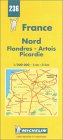  |
A good scale for driving, with road numbers and all but minor roads shown - but no hills. Scenic routes are shown by green borders along the line of the roads. Handy to have the region on one sheet. Choose whichever is cheapest! Michelin Regional Map 236
(1cm:2km): |
|
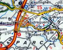
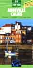
Best for walking and cycling: 1cm=1km, 4 maps needed to cover all the Nord - Pas de Calais region |
|
 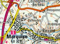 |
Greater detail also shows you hills with contours, helps you find exact location of many more tourist attractions and historic buildings, railway stations, more streets in towns, which towns have Tourist Information offices. Institut Geographique
National (IGN) local area maps: |
 Buy here -
SAVE up to 20% on maps!
Buy here -
SAVE up to 20% on maps! |
|
|
|
|
|